Aerial Rendering Services
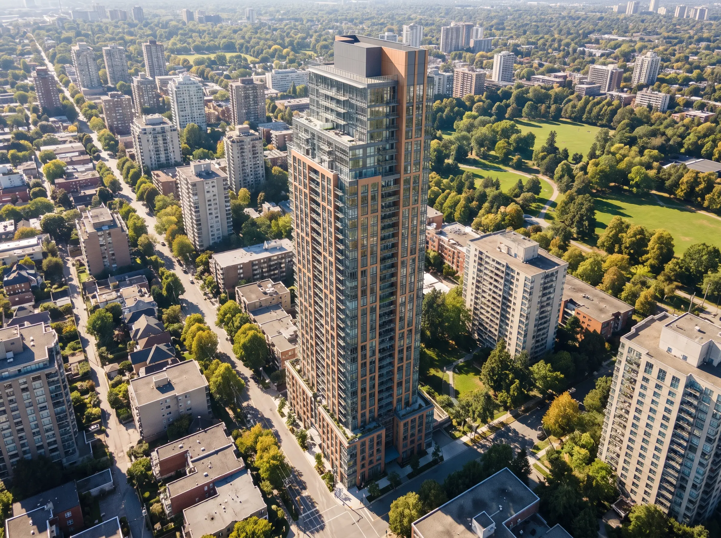
An aerial rendering is a 3D image of a building or a development seen from the air, with the streets and land around it. An aerial view costs from $699 at this studio, against a median of $900 at other studios that publish a price. The quote is fixed within 12 hours of sending files, and the first draft arrives from 48 hours.
- Price
- from $699 a view
- Further angle of the same site
- 40% less, $419
- Fixed quote
- within 12 hours
- First draft
- from 48 hours
- Revisions
- two rounds included
- Delivered as
- 4K image, day or dusk
Prices and terms as of
What is an aerial rendering?
An aerial rendering is a computer-generated image taken from a camera above the site, where a drone or a helicopter would be. It shows what a ground-level view cannot: the roof, the whole plot, the parking, the landscaping, and how the building sits among its neighbours. It is also called a bird's-eye view.
How much does an aerial rendering cost?
An aerial rendering costs from $699 a view at this studio. Seven other studios publish a price, from $350 to $1,200, with a median of $900; the 3D rendering price index lists each one. An aerial view costs more than a street view because the camera sees everything, so everything has to be modelled.
| What you order | Price |
|---|---|
| One aerial view | from $699 |
| A second aerial angle of the same site | $419 (40% less) |
| Delivery in 24 hours or less | plus 40% on the quote |
| A third revision round | 15% of the image price |
How much of the neighbourhood is modelled?
The amount of neighbourhood in the image is the main thing that moves an aerial quote. Buildings next to the site are modelled in detail because the eye compares them with yours. Buildings further away are modelled as simple blocks, or come from a photograph. The brief should say how far the view needs to reach: the plot, the block, or the skyline.
Do you need drone photos of the site?
No. An aerial rendering can be made with no photograph at all, by modelling the surroundings. A drone photograph is the other way to do it, and each suits a different site.
| Fully modelled surroundings | Drone photograph as the backdrop | |
|---|---|---|
| How it is made | The site and its neighbours are built in 3D | The building is rendered and set into your photograph |
| Best for | New districts, empty land, any camera angle | Built-up streets where the real neighbours matter |
| You send | Site plan, elevations, a map link | Site plan, elevations, the drone stills and the height they were taken from |
| Camera | Anywhere, and it can change after the draft | Fixed by the photograph |
| Changes later | A new angle is a further view at 40% less | A new angle needs a new photograph |
The quote says which of the two it prices. If you have no drone photographs and the neighbours matter, say so, and the surroundings are modelled from maps and street photographs.
What do you need to send for an aerial rendering?
- The site plan, as DWG or PDF, with the scale.
- The building model, or plans, elevations and the roof plan.
- The landscape plan, if there is one.
- The address or a map link, so the surroundings can be placed.
- Drone stills, if the image is to be set into a photograph.
- The time of day you want: daylight, golden hour or dusk.
Can the aerial and the street-level views come from one model?
Yes. The aerial view and the eye-level views are cameras on the same 3D model, which is why they are usually ordered together with exterior 3D rendering. The model is built once. A further angle of a view already ordered costs 40% less, and an order of five images or more takes 10% off.
How is an aerial rendering different from a rendered site plan?
An aerial rendering is a perspective picture, so it shows height and atmosphere but cannot be measured. A rendered site plan is drawn from directly above and to scale, so lots and distances can be read from it. Site plan rendering starts at $249 and is the one to choose for a lot map.
Are towers and large developments rendered from the air?
Yes. A tower is usually shown from a high three-quarter angle with the skyline behind it, and a development of several buildings from higher up, so the whole plot is in frame. Both need more of the city modelled than a single house, and both are quoted on the drawings.
Questions about aerial rendering
An aerial rendering shows the building from above with its roof, plot, parking, landscaping and the streets around it. It is used for development marketing, planning submissions and investor presentations.
An aerial is an exterior view taken from above, built from the same model, so it is usually ordered with the eye-level exteriors.
exterior 3D renderingRelated reading
- Site plan rendering, the same site, to scale
- Real estate rendering, the full set for a development
- 3D rendering prices, what a second angle and a rush add